search for books and compare prices
Wilderness Press has written 22 work(s)
Search for other authors with the same name
displaying 1 to 22 |
at end
show results in order: alphabetically | oldest to newest | newest to oldest


Paperback:
9780911824346 | Revised edition (Wilderness Pr, June 1, 1974), cover price $6.95 | About this edition: Book by

Paperback:
9780899972053 | Map edition (Wilderness Pr, April 1, 1999), cover price $8.95 | About this edition: This map covers the entire Marble Mountain Wilderness in far northern California.

Paperback:
9780899973746 | 3 map edition (Wilderness Pr, October 25, 2004), cover price $9.95

Paperback:
9780899973760 | 5 fol map edition (Wilderness Pr, November 22, 2004), cover price $9.95

Paperback:
9780899973654 | 1 fol map edition (Wilderness Pr, December 21, 2004), cover price $9.95 | About this edition: Find your way around Big Sur with this four-color topographic map showing every major road, trailhead, and trail in Pfeiffer Big Sur State Park, Julia Pfeiffer Burns State Park, Ventana Wilderness, Silver Peak Wilderness, Andrew Molera State Park, Lime Kiln State Park, and northern Los Padres National Forest.

Paperback:
9780899973821 | 5 map edition (Wilderness Pr, March 21, 2005), cover price $9.95

Paperback:
9780899973906 | Fol map edition (Wilderness Pr, May 1, 2005), cover price $9.95 | About this edition: This plastic map shows all the trails and climbing routes on Mt.

Paperback:
9780899973951 | Map edition (Wilderness Pr, September 1, 2005), cover price $7.95 | About this edition: This color-coded map shows all of the public open spaces on the San Francisco Peninsula, from Baker Beach in the Presidio of San Francisco down to Moss Landing State Beach in the Monterey Bay.

Paperback:
9780899973944 | Map edition (Wilderness Pr, September 1, 2005), cover price $9.95 | About this edition: This color map of the parks in the Santa Cruz Mountains covers Huddart and Wunderlich County Parks, Purisima Creek Redwoods Preserve, El Corte de Madera Creek Preserve, Edgewood County Park, and more.

Paperback:
9780899974101 | 6 map edition (Wilderness Pr, December 20, 2005), cover price $9.95 | About this edition: This completely updated, full-color recreation map covers the San Bernardino, Santa Rosa, and San Jacinto mountains, including Lake Arrowhead, Big Bear Lake, San Gorgonio Wilderness, and San Jacinto State Park.

Paperback:
9780899974217 | Fol map edition (Wilderness Pr, May 30, 2006), cover price $7.95 | About this edition: Now in its second edition, this 15-minute, 1:62,500-scale topographic map shows all the trails in Yosemite Valley as well as the backcountry to the south, including trails to Glacier Point, Half Dome, Yosemite and Vernal Falls, and Mariposa Grove's giant sequoias.

Paperback:
9780899974187 | 1 fol map edition (Wilderness Pr, June 20, 2006), cover price $9.95 | About this edition: This completely updated, full-color recreation map covers Desolation Wilderness, as well as Fallen Leaf Lake and Emerald Bay, and shows trails, campgrounds, ranger stations, springs, streams, rivers, lakes, and surrounding roads and towns.

Paperback:
9780899973555 | Fol map edition (Wilderness Pr, May 1, 2004), cover price $9.95

Paperback:
9780899974651 | 2 fol map edition (Wilderness Pr, September 1, 2007), cover price $9.95 | About this edition: Find your way around Point Reyes National Seashore and vicinity with this four-color topographic map showing every major road, trailhead, and trail in the park.

Paperback:
9780899974774 | 4 fol map edition (Wilderness Pr, June 15, 2008), cover price $9.95 | About this edition: Covering the 106,372-acre park, as well as thousands of acres of surrounding land in the Lassen National Forest, Caribou, Thousand Lakes, Hat Creek Valley, and McArthur-Burney Falls State Parkâthis map has been completely updated for even more comprehensive coverage and easier use.

Paperback:
9780899974392 | 2 fol map edition (Wilderness Pr, June 15, 2008), cover price $7.95 | About this edition: Now completely updated for its second edition, this 15-minute, 1:62,500-scale topographic map shows one of the most popular sections of the High Sierra, with five peaks over 14,000 feet--Mt.

Paperback:
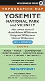
9780899974880 | 7 fol map edition (Wilderness Pr, September 15, 2008), cover price $9.95 | About this edition: Covers Yosemite National Park and most of Ansel Adams Wilderness, Emigrant Wilderness and Hoover Wilderness.
Paperback:
9780899974460, titled "Backpacking California: Mountain, Foothill, Coastal, & Desert Adventures in the Golden State" | 2 edition (Wilderness Pr, August 1, 2008), cover price $24.95
Miscellaneous:
9780899975146, titled "Backpacking California: Mountain, Foothill, Coastal and Desert Adventures in the Golden State" | Wilderness Pr, May 10, 2010, cover price $22.95

Paperback:
9780899977690 | 2 fol map edition (Wilderness Pr, June 10, 2014), cover price $9.95

Paperback:
9780899978253 | Wilderness Pr, May 10, 2016, cover price $16.95 | About this edition: All across the country, unused railroad corridors have been converted to public multiuse trails.
Paperback:
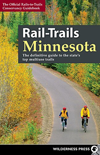
9780899978215 | Wilderness Pr, May 10, 2016, cover price $16.95 | About this edition: Whether you’re looking for a trail for a leisurely stroll, a bike ride with the family, or something a bit more challenging, you’ll find it in this comprehensive trail guide highlighting the best, most highly rated trails in Minnesota.

Paperback:
9780899978291 | 7 fol map edition (Wilderness Pr, October 11, 2016), cover price $9.95
displaying 1 to 22 |
at end